Duration: 6 hours (walking time 4.45')
Altitude: from 30 m. (Panagia chapel) to 644 m. (top)
Total elevation gain: 839 m. Total elevation loss: 754 m.
Signed with red paint marks
Drinking water on walk: no
Download GPS track: from Everytrail from Wikiloc
At the south end of the Pelion peninsula, after the gently descending foothills of Lafkos fade out, the rocky and arid mountain of Tiseon (previously called Bartzogia by locals) rises up. On its boundary, at the entrance to the Pagasitic Gulf, the village of Trikeri is built. There is no proper path joining Trikeri to the rest of Pilion, and communication was only by sea. However, there is a path from the village which goes along the mountain ridge and descends to the sea to the chapel of Panagia.

Going along the
coast road from Milina to Trikeri, we pass the fish farm and then see
a sign next to the road with the inscription ''ΙEΡΟΣ ΝΑΟΣ ΠΑΝΑΓΙΑΣ'' (in Greek).
The chapel is a little lower down near the sea, not visible from the road. Next to the road
there is also a fallen marble memorial plaque commemorating the fight
in 1823 of the Greek revolutionaries under the leadership of Karatasos
against the Turkish army led by Kioutachi pasha.
 |
| Tzasteni, on the way to Trikeri |
The footpath, indicated by
red marks, begins here from the side of the road and ascends
through the maquis vegetation. We pass through a first clearing and
shortly come out at a larger long narrow one, called the Karatasos glade.
Walking along its length, half way along we find the path to the
left, indicated by red marks and a small sign, which leads towards to
peak. Walking to the east, we come out at a new clearing on the col.
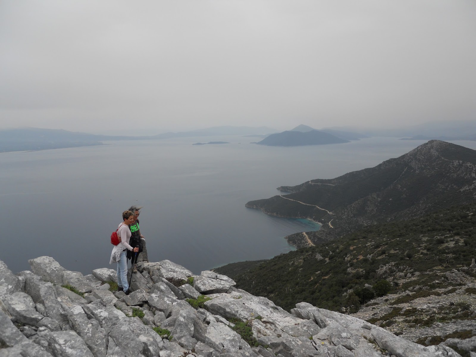
From the col we begin to ascend on goat tracks over rocky terrain with low vegetation which thins out as we continue climbing in an easterly direction. We pass successive cairns and keep to the southern edge of the ridge (towards the Aegean side). We eventually reach the highest point (644 m) where there is a cement column after about one hour and forty minutes of walking (two hours with stops).


From the col we begin to ascend on goat tracks over rocky terrain with low vegetation which thins out as we continue climbing in an easterly direction. We pass successive cairns and keep to the southern edge of the ridge (towards the Aegean side). We eventually reach the highest point (644 m) where there is a cement column after about one hour and forty minutes of walking (two hours with stops).

From here, especially on a
clear day, we can enjoy a unique view of Greek nature, which
compensates us amply for any difficulty we may have had in reaching
this point. At moments like these we feel fortunate to be in this
much-afflicted place enjoying the magical and unique beauty that it
has been blessed with. Rocks and cliffs, sky and sea, white and blue
– we can’t take in enough of the view all around us. It’s not
possible to describe the feeling – one has to experience it for
oneself. In the words of the unforgettable Nikos Haratsis: “I don’t
know, Lord, how else to sing the praises of this holy place that you
have given us”.


Comes the time when we
must set out on our return. We go back to the Karatasos glade, from
the upper (western) edge of which a path continues, marked by red marks,
in a southwesterly direction. We pass a new clearing and, further on,
the path becomes unclear as we ascend over a rocky hill, at the top
of which there is an antenna. In this
recording, we go downhill on goat tracks under the antenna in a northwesterly direction until we meet a straight,
narrow path a little further down, which we follow to the left
(southwest) to come out at the glade on the col below the antenna.
One reaches the same glade if one proceeds straight ahead to the
southwest below the antenna going downhill, again on goat tracks.
 |
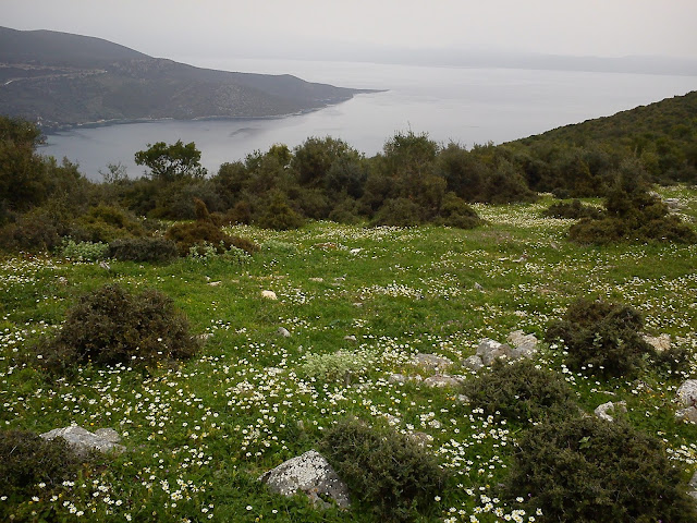
| Seeing Trikeri at the distance |
From the glade,
moving to the west, we ascend on a narrow path-goat track, pass
another glade and go up to the top of the next hill. In the same
direction, after a short distance, the path leads us to another hill
(Kastro, 281 m), where we find a wall extending for quite a distance
along the ridge, and we walk next to this. The wall was built hastily at the
time of the battles with Kioutachis’ army in 1823 (more details are
available in Kostas Liapis’ book (''Τα
Παλιόκαστρα του
Πηλίου'', Volos 2010-in Greek).


Continuing in the
same westerly direction, we pass next to the asphalt road and take
the narrow earth road which, after a short distance, comes to col
next to a goat pen. Here we meet the asphalt road that leads left to
Agia Kiriaki and the trail recording ends. If we cross the
road and take the narrow earth road that we see to ascend the
slope, we will reach the village of Trikeri in about forty
five minutes. From there we can continue, if we want, for about
thirty minutes (see the walk description Agia Kiriaki – Trikeri) on
the well-maintained kalderimi that leads down to the picturesque coastal
settlement –harbour of Agia Kiriaki.
 |
| Agia Kiriaki |
No comments:
Post a Comment